Flood Risk - a real threat?
Take a look at the Environment Agency's map of Westbourne. The land designated for development is next to the area coloured blue on the map.
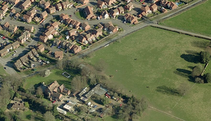
Go and take a look at the stream in the meadows to the north of Foxbury Lane.
Take a look at the Environment Agency's map of Westbourne. The land designated for development is next to the area coloured blue on the map.
Go and take a look at the stream in the meadows to the north of Foxbury Lane.

No comments:
Post a Comment